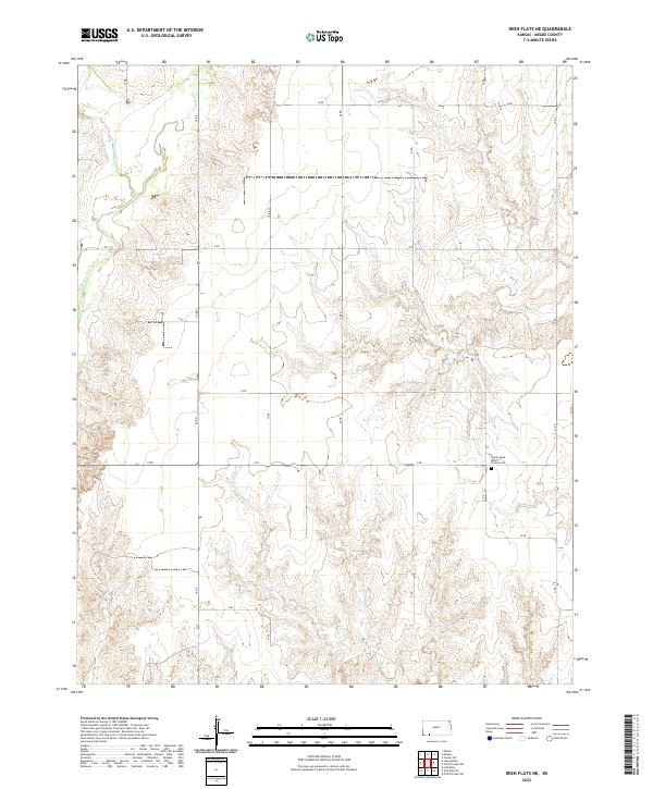
2022 Map of Irish Flats NE
USGS Topo · Published 2022About this map
Countryside Bible Church Cem serves as a prominent landmark in the southeastern portion of this Meade County landscape, where the High Plains transition into a network of seasonal drainage patterns. The terrain is defined by a rigorous grid of section-line roads, including 18 RD and V RD, which impose a geometric order over the winding courses of Crooked Cr and Spring Cr. These waterways, along with Sand Cr and Remuda Cr, illustrate the intermittent hydrography typical of western Kansas, where water flow is often dictated by seasonal precipitation. The land division, documented here through townships such as t32s r28w and t33s r27w, reflects the enduring legacy of the Public Land Survey System in organizing the agricultural and pastoral life of the region.
Find a feature on this map
24 named features on this map. Tap any name to fly to it.
Don’t see what you’re looking for? This feature index may not catch every label — zoom into the map to look around manually.
Map Details
Editions of this 2022 Irish Flats NE Map
This is the sole edition of this map. No revisions or reprints were ever made.
Other maps of this area

1892 · Meade
USGS Topo · 1:125,000

1955 · Dodge City
USGS Topo · 1:250,000

1958 · Dodge City
USGS Topo · 1:250,000

1959 · Dodge City
USGS Topo · 1:250,000

1962 · Irish Flats NE
USGS Topo · 1:24,000

1962 · Irish Flats SE
USGS Topo · 1:24,000

1963 · Lake Larrabee
USGS Topo · 1:24,000

1963 · Irish Flats
USGS Topo · 1:24,000

1963 · Meade
USGS Topo · 1:24,000

1963 · Missler
USGS Topo · 1:24,000