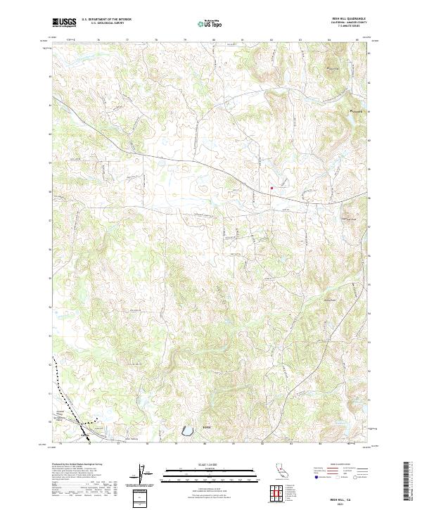
2021 Map of Irish Hill
USGS Topo · Published 2021About this map
Irish Hill rises above the transition where the eastern edge of the Sacramento Valley meets the foothills of Amador County. This landscape is defined by its complex drainage network and historic water infrastructure, including the Arroyo Seco Ditch and numerous creeks like Willow Cr and Dry Cr. The settlement pattern centers on the established community of Plymouth in the northeast and the northern reaches of Ione in the south, connected by a web of rural routes such as the Old Plymouth-Sacto Finn Ranch Rd. Topographical features such as Bisbee Peak, Sugarloaf Peak, and Rocky Point provide prominent landmarks across the terrain. Local history is reflected in names like Spanish Gulch and New York Gulch, hinting at the area's gold-era heritage and the subsequent development of water storage at Henderson Reservoir and Goffinet Reservoir.
Find a feature on this map
79 named features on this map. Tap any name to fly to it.
Don’t see what you’re looking for? This feature index may not catch every label — zoom into the map to look around manually.
Map Details
Editions of this 2021 Irish Hill Map
This is the sole edition of this map. No revisions or reprints were ever made.
Other maps of this area

1889 · Jackson
USGS Topo · 1:125,000

1891 · Sacramento
USGS Topo · 1:125,000

1891 · Placerville
USGS Topo · 1:125,000

1892 · Jackson
USGS Topo · 1:125,000

1892 · Sacramento
USGS Topo · 1:125,000

1892 · Placerville
USGS Topo · 1:125,000

1893 · Placerville
USGS Topo · 1:125,000

1893 · Sacramento
USGS Topo · 1:125,000

1894 · Lodi
USGS Topo · 1:125,000

1897 · Jackson
USGS Topo · 1:125,000