
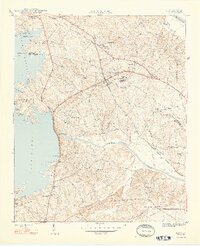
1948 Map of Irmo
USGS Topo · Published 1948About this map
The Columbia Newberry and Laurens railroad cuts a diagonal path through the landscape of the mid-1940s, connecting the village of Irmo and the settlement at Ballentine. This era represents a significant period of institutional development for the local African American community, anchored by the Harbison Institute and the Rosenwald Sch located near Grange Hall. These sites reflect the region's educational history before major suburban expansion transformed the area.
Find a feature on this map
46 named features on this map. Tap any name to fly to it.
Don’t see what you’re looking for? This feature index may not catch every label — zoom into the map to look around manually.
Map Details
Editions of this 1948 Irmo Map
2 editions found
Other maps of this area

1904 · Columbia
USGS Topo · 1:125,000

1941 · Spartanburg
USGS Topo · 1:250,000

1944 · Gilbert
USGS Topo · 1:62,500

1944 · Edmund
USGS Topo · 1:62,500

1946 · Irmo
USGS Topo · 1:24,000

1947 · Columbia North
USGS Topo · 1:24,000

1947 · Richtex
USGS Topo · 1:24,000

1948 · Columbia North
USGS Topo · 1:24,000

1949 · Richtex
USGS Topo · 1:24,000

1949 · Irmo NE
USGS Topo · 1:24,000