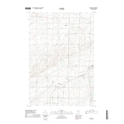
2018 Map of Iron Belt
USGS Topo · Published 2018About this map
Iron Belt and Montreal anchor this 2018 survey of Iron County, Wisconsin, where the landscape is defined by the headwaters of the West Fork Montreal River and the Potato River. The town of Iron Belt serves as a geographic center, reflecting the area's industrial legacy through local landmarks like Plummer Mine Rd. Nearby, Hillside Cem and the settlement of Pence provide specific points of interest for genealogists tracing family roots in this northern mining and timber region.
Find a feature on this map
56 named features on this map. Tap any name to fly to it.
Don’t see what you’re looking for? This feature index may not catch every label — zoom into the map to look around manually.
Map Details
Editions of this 2018 Iron Belt Map
This is the sole edition of this map. No revisions or reprints were ever made.
Other maps of this area

1940 · Upson
USGS Topo · 1:48,000

1943 · Little Girls Point
USGS Topo · 1:24,000

1943 · Upson
USGS Topo · 1:48,000

1943 · Ironwood
USGS Topo · 1:48,000

1943 · Little Girl Point
USGS Topo · 1:48,000

1953 · Ashland
USGS Topo · 1:250,000

1955 · Ironwood
USGS Topo · 1:24,000

1955 · Ironwood
USGS Topo · 1:62,500
1956 · Saxon
USGS Topo · 1:24,000

1956 · North Ironwood
USGS Topo · 1:62,500