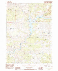
1984 Map of Iron Gate Reservoir
USGS Topo · Published 1984About this map
Iron Gate Reservoir dominates this Siskiyou County landscape, a central water body created by the Iron Gate Dam along the Klamath River. The 1980s terrain shows a developed recreational and resource management infrastructure, including the Iron Gate Fish Hatchery and several access points like Mirror Cove and Juniper Point. To the north, Camp Creek Campground and Wanaka Spring mark points of local interest among the complex gulches and ridges. The southwestern corner reveals the passage of the Southern Pacific railroad line through the river valley, where local roads such as Ager Road and Hornbrook Road converge. Significant drainages like Bogus Creek and Jenny Creek feed into the reservoir system, illustrating the watershed's role in local irrigation and power generation during this era.
Find a feature on this map
37 named features on this map. Tap any name to fly to it.
Don’t see what you’re looking for? This feature index may not catch every label — zoom into the map to look around manually.
Map Details
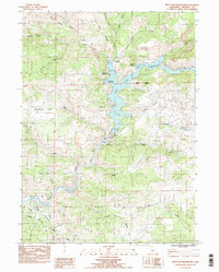
Editions of this 1984 Iron Gate Reservoir Map
2 editions found
Other maps of this area

1886 · Shasta
USGS Topo · 1:250,000

1891 · Ashland
USGS Topo · 1:250,000

1893 · Ashland
USGS Topo · 1:250,000

1894 · Shasta
USGS Topo · 1:250,000

1897 · Ashland
USGS Topo · 1:250,000

1922 · Shasta Valley Sheet No 13
USGS Topo · 1:24,000

1922 · Shasta Valley Sheet No 16
USGS Topo · 1:24,000

1922 · Shasta Valley Sheet No 15
USGS Topo · 1:24,000

1922 · Shasta Valley Sheet No 14
USGS Topo · 1:24,000

1932 · Yreka
USGS Topo · 1:96,000