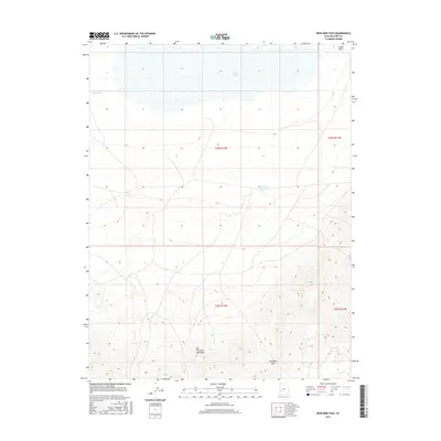
2017 Map of Iron Mine Pass
USGS Topo · Published 2017About this map
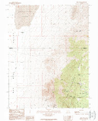
The San Francisco Mountains dominate the southern half of this Millard County landscape, rising sharply above the desert floor and terminating at the natural saddle of Iron Mine Pass. This pass serves as a key topographical transition between the high peaks and the drainage systems to the north. In the northern reaches of the quadrangle, the terrain flattens significantly as it approaches the vast, often dry bed of Sevier Lake. Sparse water management features like Horsetrap Reservoir and Lakeview Reservoir are scattered across these lower elevations, indicating the critical role of water capture in this arid environment. The map provides a clear look at the township and range divisions, such as t25s r12w, and the natural erosion patterns of Cedar Wash, illustrating the intersection of modern surveying and an unforgiving geologic landscape.
Find a feature on this map
10 named features on this map. Tap any name to fly to it.
Don’t see what you’re looking for? This feature index may not catch every label — zoom into the map to look around manually.
Map Details
Editions of this 2017 Iron Mine Pass Map
This is the sole edition of this map. No revisions or reprints were ever made.
Other maps of this area

1953 · Richfield
USGS Topo · 1:250,000

1958 · Richfield
USGS Topo · 1:250,000
1960 · Frisco Peak
USGS Topo · 1:62,500
1960 · Beaver Lake Mts.
USGS Topo · 1:62,500
1960 · The Barn
USGS Topo · 1:62,500
1972 · Headlight Mtn
USGS Topo · 1:24,000
1972 · Sevier Lake SW
USGS Topo · 1:24,000
1980 · Wah Wah Mts. North
USGS Topo · 1:100,000
1989 · High Rock
USGS Topo · 1:24,000
1989 · Frisco Peak
USGS Topo · 1:24,000