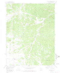
1980 Map of Iron Mountain
USGS Topo · Published 1981About this map
Green Mountain Mine and Iron Mountain Mine stand as primary landmarks in this 1980 survey of the borderlands between Fremont and Custer Counties. The landscape is defined by a dense network of water sources and drainage features, including Indian Springs, Mow Spring, and the prominent Mc Clure Spring. These water points were critical for early settlement and industrial operations in this arid region, sustaining both the mining sites and established areas like Indian Springs Park and Cody Park.
Find a feature on this map
44 named features on this map. Tap any name to fly to it.
Don’t see what you’re looking for? This feature index may not catch every label — zoom into the map to look around manually.
Map Details
Editions of this 1980 Iron Mountain Map
4 editions found
Other maps of this area

1889 · Canon City
USGS Topo · 1:125,000

1892 · Canon City
USGS Topo · 1:125,000

1954 · Mount Tyndall
USGS Topo · 1:24,000

1954 · Pueblo
USGS Topo · 1:250,000

1955 · Westcliffe
USGS Topo · 1:24,000

1957 · Pueblo
USGS Topo · 1:250,000

1958 · Pueblo
USGS Topo · 1:250,000

1958 · Beckwith Mountain
USGS Topo · 1:24,000

1959 · Electric Peak
USGS Topo · 1:62,500

1959 · Royal Gorge
USGS Topo · 1:62,500