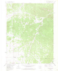
1980 Map of Iron Mountain
USGS Topo · Published 1982About this map
Iron Mountain Mine and Green Mountain Mine anchor the industrial geography of this Colorado landscape, situated amidst a complex network of high-elevation peaks and gulches. The terrain is characterized by broad open areas like Indian Springs Park, Cody Park, and Goat Park, which are interspersed between prominent heights such as Mc Clure Mountain and Elkhorn Mountain. The drainage system is particularly dense, with Pine Gulch, Sawmill Gulch, and Westfall Gulch carving through the mountainsides toward Grape Creek at the southern boundary.
Find a feature on this map
37 named features on this map. Tap any name to fly to it.
Don’t see what you’re looking for? This feature index may not catch every label — zoom into the map to look around manually.
Map Details
Editions of this 1980 Iron Mountain Map
4 editions found
Other maps of this area

1889 · Canon City
USGS Topo · 1:125,000

1892 · Canon City
USGS Topo · 1:125,000

1954 · Mount Tyndall
USGS Topo · 1:24,000

1954 · Pueblo
USGS Topo · 1:250,000

1955 · Westcliffe
USGS Topo · 1:24,000

1957 · Pueblo
USGS Topo · 1:250,000

1958 · Pueblo
USGS Topo · 1:250,000

1958 · Beckwith Mountain
USGS Topo · 1:24,000

1959 · Electric Peak
USGS Topo · 1:62,500

1959 · Royal Gorge
USGS Topo · 1:62,500