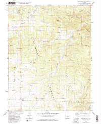
1980 Map of Iron Mountain
USGS Topo · Published 1985About this map
De Weese Plateau dominates this high-altitude landscape in southern Colorado, revealing a complex network of gulches and ridges that defines the transition between Fremont and Custer Counties. Settled activity is concentrated in pockets such as Democratic and Titusville, where the geography suggests small-scale ranching and mineral exploration. The presence of the Iron Mountain Mine and Green Mountain Mine speaks to the region's mining legacy, while the distribution of Indian Springs, Mow Spring, and Falling Rock Spring highlights the critical importance of water sources in this arid environment.
Find a feature on this map
36 named features on this map. Tap any name to fly to it.
Don’t see what you’re looking for? This feature index may not catch every label — zoom into the map to look around manually.
Map Details
Editions of this 1980 Iron Mountain Map
4 editions found
Other maps of this area

1889 · Canon City
USGS Topo · 1:125,000

1892 · Canon City
USGS Topo · 1:125,000

1954 · Mount Tyndall
USGS Topo · 1:24,000

1954 · Pueblo
USGS Topo · 1:250,000

1955 · Westcliffe
USGS Topo · 1:24,000

1957 · Pueblo
USGS Topo · 1:250,000

1958 · Pueblo
USGS Topo · 1:250,000

1958 · Beckwith Mountain
USGS Topo · 1:24,000

1959 · Electric Peak
USGS Topo · 1:62,500

1959 · Royal Gorge
USGS Topo · 1:62,500