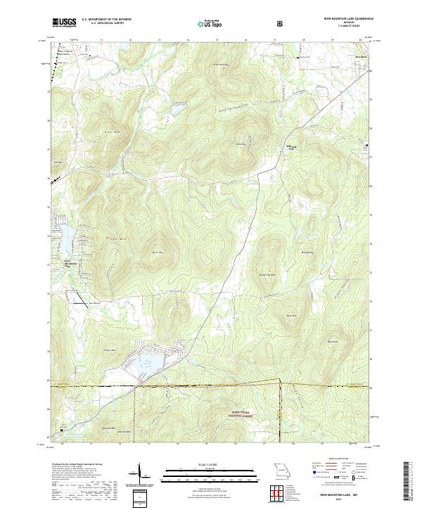
2021 Map of Iron Mountain Lake
USGS Topo · Published 2021About this map
Iron Mountain Lake and the surrounding peak-heavy terrain of the Saint Francois Mountains define this section of Missouri. The landscape is a dense assembly of summits, including Bread Tray Mtn, Wolf Mtn, and Stono Mtn, interspersed with hollows like South Spring Hollow and Ironton Hollow. Settlement is concentrated around the lake and the communities of Doe Run and Mineral City, while the southern reaches transition into the protected lands of the Mark Twain National Forest. Local history is preserved in several rural burial grounds such as German Cem and Grider Cem. The region's industrial and recreational history is evidenced by water bodies like Pilot Knob Lake and the Pilot Knob Pellet Company Lake Number 2, alongside the small Dove Airstrip. This topographic study provides a detailed view of the complex drainage systems formed by Indian Creek and the Saint Francis River as they wind through the high-relief interior of the Ozark plateau.
Find a feature on this map
75 named features on this map. Tap any name to fly to it.
Don’t see what you’re looking for? This feature index may not catch every label — zoom into the map to look around manually.
Map Details
Editions of this 2021 Iron Mountain Lake Map
This is the sole edition of this map. No revisions or reprints were ever made.
Other maps of this area

1904 · Farmington
USGS Topo · 1:62,500

1905 · Bonneterre
USGS Topo · 1:62,500

1906 · Farmington
USGS Topo · 1:62,500

1937 · Ironton
USGS Topo · 1:48,000

1939 · Fredericktown
USGS Topo · 1:48,000

1945 · Ironton
USGS Topo · 1:62,500

1946 · Ironton
USGS Topo · 1:62,500

1947 · Fredericktown
USGS Topo · 1:62,500

1949 · Rolla
USGS Topo · 1:250,000

1950 · Fredericktown
USGS Topo · 1:62,500