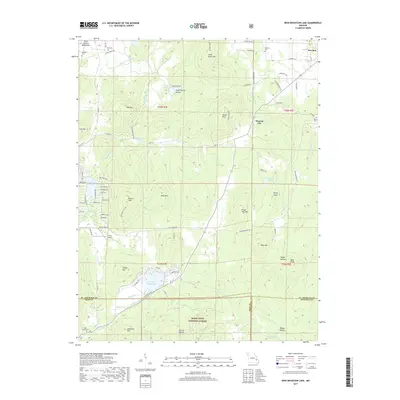
2017 Map of Iron Mountain Lake
USGS Topo · Published 2017About this map
Iron Mountain Lake and the rugged peaks of the Saint Francois Mountains anchor this 2017 survey of the Missouri Ozarks. The landscape is defined by its topographic extremes, ranging from the high elevations of Stono Mtn and Wolf Mtn to the deeply carved ravines of South Spring Hollow and Seego Hollow. This modern snapshot of the area shows a complex mix of protected lands within the Mark Twain National Forest and established residential developments.
Find a feature on this map
92 named features on this map. Tap any name to fly to it.
Don’t see what you’re looking for? This feature index may not catch every label — zoom into the map to look around manually.
Map Details
Editions of this 2017 Iron Mountain Lake Map
This is the sole edition of this map. No revisions or reprints were ever made.
Other maps of this area

1904 · Farmington
USGS Topo · 1:62,500

1905 · Bonneterre
USGS Topo · 1:62,500

1906 · Farmington
USGS Topo · 1:62,500

1937 · Ironton
USGS Topo · 1:48,000

1939 · Fredericktown
USGS Topo · 1:48,000

1945 · Ironton
USGS Topo · 1:62,500

1946 · Ironton
USGS Topo · 1:62,500

1947 · Fredericktown
USGS Topo · 1:62,500

1949 · Rolla
USGS Topo · 1:250,000

1950 · Fredericktown
USGS Topo · 1:62,500