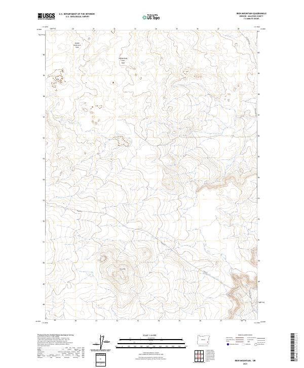
2023 Map of Iron Mountain
USGS Topo · Published 2023About this map
Iron Mtn rises as a prominent landmark in this corner of Malheur County, anchoring a landscape defined by volcanic geology and remote transit corridors. The northern portion of the map is dominated by the Saddle Butte Lava Field, a region characterized by its distinct basaltic formations including the Saddle Butte Lava Tube. This area represents the stark, high-desert terrain of southeastern Oregon, where the environment dictates the patterns of human movement and land use.
Find a feature on this map
12 named features on this map. Tap any name to fly to it.
Don’t see what you’re looking for? This feature index may not catch every label — zoom into the map to look around manually.
Map Details
Editions of this 2023 Iron Mountain Map
This is the sole edition of this map. No revisions or reprints were ever made.
Other maps of this area

1955 · Jordan Valley
USGS Topo · 1:250,000

1955 · Boise
USGS Topo · 1:250,000

1957 · Jordan Valley
USGS Topo · 1:250,000

1958 · Boise
USGS Topo · 1:250,000

1958 · Jordan Valley
USGS Topo · 1:250,000

1962 · Boise
USGS Topo · 1:250,000

1972 · Palomino Hills
USGS Topo · 1:24,000
1972 · Wrangle Butte
USGS Topo · 1:24,000
1972 · Saddle Butte
USGS Topo · 1:24,000

1972 · Owyhee Butte
USGS Topo · 1:24,000