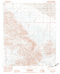
1983 Map of Iron Mountains
USGS Topo · Published 1983About this map
The Iron Mountains dominate this landscape in the early 1980s, marking a rugged division between the Ward Valley and Cadiz Valley. This industrial desert corridor is defined by massive infrastructure projects, most notably the Colorado River Aqueduct which cuts across the southern portion of the quadrangle. The aqueduct's path is facilitated by the Iron Mountain Tunnel, a significant engineering feat required to traverse the mountain range.
Find a feature on this map
16 named features on this map. Tap any name to fly to it.
Don’t see what you’re looking for? This feature index may not catch every label — zoom into the map to look around manually.
Map Details
Editions of this 1983 Iron Mountains Map
2 editions found
Other maps of this area

1942 · Amboy
USGS Topo · 1:250,000

1943 · Amboy
USGS Topo · 1:250,000

1943 · Cadiz Lake
USGS Topo · 1:62,500

1943 · Cadiz Valley
USGS Topo · 1:62,500

1943 · Iron Mountains
USGS Topo · 1:62,500

1954 · Needles
USGS Topo · 1:250,000

1956 · Needles
USGS Topo · 1:250,000

1956 · Milligan
USGS Topo · 1:62,500

1956 · Iron Mountains
USGS Topo · 1:62,500

1956 · Cadiz Lake
USGS Topo · 1:62,500