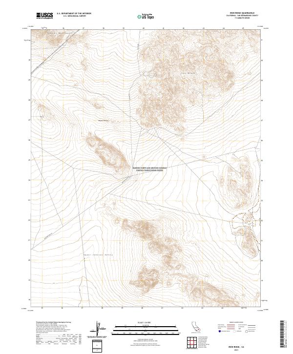
2021 Map of Iron Ridge
USGS Topo · Published 2021About this map
Iron Ridge rises above the high desert floor in this 2021 look at a remote corner of San Bernardino County. The landscape is dominated by the Rodman Mountains to the north and the broad expanse of the Upper Johnson Valley to the south, both part of the greater Mojave Desert ecosystem. This map documents a region where human presence is primarily marked by industrial and transit infrastructure rather than permanent settlements. Transport through this arid terrain relies on a handful of specialized corridors, including the utility-focused Transmission Line Rd and Bessemer Mine Rd, which likely serves historic mining interests in the surrounding hills. The map provides a clear record of the Public Land Survey System grid across these townships, showing how the desert was partitioned even in areas without traditional township development.
Find a feature on this map
13 named features on this map. Tap any name to fly to it.
Don’t see what you’re looking for? This feature index may not catch every label — zoom into the map to look around manually.
Map Details
Editions of this 2021 Iron Ridge Map
This is the sole edition of this map. No revisions or reprints were ever made.
Other maps of this area

1901 · Southern California Sheet No. 1
USGS Topo · 1:250,000

1902 · San Gorgonio
USGS Topo · 1:125,000

1904 · Southern California Sheet No. 1
USGS Topo · 1:250,000

1953 · San Bernardino
USGS Topo · 1:250,000

1954 · Galway Lake
USGS Topo · 1:24,000

1954 · Emerson Lake
USGS Topo · 1:24,000

1955 · Silver Bell Mine
USGS Topo · 1:24,000

1955 · Sunshine Peak
USGS Topo · 1:24,000

1955 · Old Woman Springs
USGS Topo · 1:62,500

1955 · Lavic
USGS Topo · 1:62,500