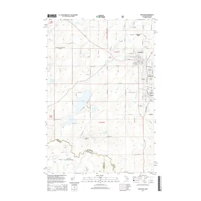
2014 Map of Iron River
USGS Topo · Published 2014About this map
The Iron River corridor serves as the industrial and residential heart of this region in the Upper Peninsula, connecting several distinct settlements during the mid-2010s. The contiguous communities of Stambaugh, Caspian, and Mineral Hills flank the main township, while the smaller settlement of Palatka sits further south along the riverbanks. This concentration of urban development is surrounded by the expansive reaches of the Ottawa National Forest, where high points like Sheridan Hill overlook a landscape dotted with glacial water bodies including Stanley Lake, Snipe Lake, and Holmes Lake. The presence of several dedicated burial grounds, such as Resthaven Cem and Iron River Cem, alongside the Stambaugh Airport, suggests a well-established infrastructure that serves both the local population and the seasonal visitors to the north woods and the Nicolet National Forest across the state line.
Find a feature on this map
114 named features on this map. Tap any name to fly to it.
Don’t see what you’re looking for? This feature index may not catch every label — zoom into the map to look around manually.
Map Details
Editions of this 2014 Iron River Map
This is the sole edition of this map. No revisions or reprints were ever made.
Other maps of this area

1898 · Iron River
USGS Topo · 1:62,500

1938 · Alvin
USGS Topo · 1:48,000

1939 · Long Lake
USGS Topo · 1:48,000

1944 · Iron River
USGS Topo · 1:24,000

1944 · Gaastra
USGS Topo · 1:24,000

1945 · Gibbs City
USGS Topo · 1:24,000

1945 · Sunset Lake
USGS Topo · 1:24,000

1946 · Iron River
USGS Topo · 1:31,680

1946 · Sunset Lake
USGS Topo · 1:31,680

1946 · Gaastra
USGS Topo · 1:31,680