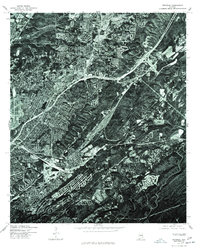
1975 Map of Irondale
USGS Topo · Published 1977About this map
Irondale and the surrounding Jefferson County landscape are captured in this mid-1970s orthophotoquad, which uses rectified aerial imagery rather than traditional line-and-tint cartography. The overhead view reveals a complex geography where heavy industrial infrastructure and suburban expansion meet the steep ridges and valleys of the Birmingham area. Dense residential clusters and commercial corridors contrast sharply with the winding roads and wooded slopes of the nearby elevations. The center of Irondale is clearly defined by its concentration of structures and transportation routes, providing an exceptionally detailed view of the town's physical footprint during a decade of significant regional growth. This specific imagery was captured on December 1, 1975, offering researchers a clear look at property lines, land use, and the specific density of the built environment just before the late 20th-century development surge.
Find a feature on this map
1 named feature on this map. Tap any name to fly to it.
Don’t see what you’re looking for? This feature index may not catch every label — zoom into the map to look around manually.
Map Details
Editions of this 1975 Irondale Map
This is the sole edition of this map. No revisions or reprints were ever made.
Other maps of this area

1889 · Birmingham
USGS Topo · 1:125,000

1890 · Bessemer
USGS Topo · 1:125,000

1892 · Birmingham
USGS Topo · 1:125,000

1892 · Bessemer
USGS Topo · 1:125,000

1895 · Birmingham
USGS Topo · 1:125,000

1904 · Birmingham Coal District
USGS Topo · 1:62,500

1905 · Bessemer Iron District
USGS Topo · 1:62,500

1905 · Leeds
USGS Topo · 1:62,500

1906 · Birmingham Special
USGS Topo · 1:62,500

1906 · Vandiver
USGS Topo · 1:62,500