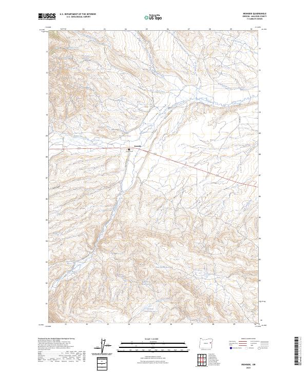
2023 Map of Ironside
USGS Topo · Published 2023About this map
Ironside stands at the heart of this high-desert landscape in Malheur County, where the agricultural life of Ironside Valley is clearly visible through a complex network of water management. The community is served by the Ironside Cem and relies on a series of critical water storage and transport systems, including Moltham Reservoir One, Moltham Reservoir Two, and Moltham Reservoir Three. These reservoirs, along with features like The Ponds Reservoir, feed into irrigation works such as Rutherford Ditch and Duncan Ditch. The terrain is defined by its drainages, from the northern Picnic Boulder Creek to South Willow Creek in the south, while routes like Molthon Ranch Rd and Rose Creek Rd trace the paths of local ranchers and settlers through Lost Valley and Sand Gulch.
Find a feature on this map
37 named features on this map. Tap any name to fly to it.
Don’t see what you’re looking for? This feature index may not catch every label — zoom into the map to look around manually.
Map Details
Editions of this 2023 Ironside Map
This is the sole edition of this map. No revisions or reprints were ever made.
Other maps of this area

1908 · Ironside Mountain
USGS Topo · 1:125,000

1955 · Baker
USGS Topo · 1:250,000

1955 · Canyon City
USGS Topo · 1:250,000

1959 · Baker
USGS Topo · 1:250,000

1959 · Canyon City
USGS Topo · 1:250,000

1964 · Ironside
USGS Topo · 1:62,500

1966 · Clover Creek Ranch
USGS Topo · 1:62,500

1970 · Castle Rock
USGS Topo · 1:62,500
1972 · Hereford
USGS Topo · 1:24,000
1972 · Eldorado Pass
USGS Topo · 1:24,000