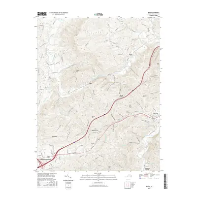
2016 Map of Ironto
USGS Topo · Published 2016About this map
The confluence of the North Fork Roanoke River and South Fork Roanoke River defines the lower drainage of this Montgomery County landscape, where the town of Christiansburg anchors the southwestern corner. This area serves as a significant transit corridor through the Blue Ridge foothills, evidenced by the presence of Big Tunnel and the path of modern thoroughfares through Montgomery and Shawsville. Local history is preserved in small settlements and family landmarks such as Den Hill Cemetery and the site of Brush Harbor.
Find a feature on this map
130 named features on this map. Tap any name to fly to it.
Don’t see what you’re looking for? This feature index may not catch every label — zoom into the map to look around manually.
Map Details
Editions of this 2016 Ironto Map
This is the sole edition of this map. No revisions or reprints were ever made.
Other maps of this area

1890 · Christiansburg
USGS Topo · 1:125,000

1923 · Waiteville
USGS Topo · 1:62,500

1929 · Salem
USGS Topo · 1:48,000

1931 · Waiteville
USGS Topo · 1:48,000

1932 · Salem
USGS Topo · 1:62,500

1932 · Blacksburg
USGS Topo · 1:48,000

1937 · Blacksburg
USGS Topo · 1:62,500

1944 · Waiteville
USGS Topo · 1:62,500

1950 · Elliston
USGS Topo · 1:62,500

1951 · Waiteville
USGS Topo · 1:62,500