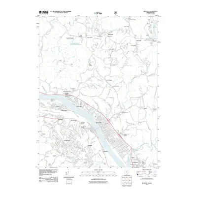
2011 Map of Ironton
USGS Topo · Published 2011About this map
The Ohio River corridor at the turn of the 21st century reveals a landscape defined by heavy industry and river-town development. Industrial sites like Armco Steel anchor the riverbank near Riverview, while major rail lines including CSX Transportation and Norfolk Southern parallel the water, facilitating the region's historical connection to coal and steel. Across the river in Kentucky, the suburban expansion of Flatwoods and Russell contrasts with the dense grid of Ironton and its surrounding communities like Coal Grove and Hanging Rock.
Find a feature on this map
234 named features on this map. Tap any name to fly to it.
Don’t see what you’re looking for? This feature index may not catch every label — zoom into the map to look around manually.
Map Details
Editions of this 2011 Ironton Map
This is the sole edition of this map. No revisions or reprints were ever made.
Other maps of this area

1898 · Ironton
USGS Topo · 1:62,500

1900 · Ironton
USGS Topo · 1:62,500

1901 · Ceredo
USGS Topo · 1:62,500

1903 · Kenova
USGS Topo · 1:125,000

1904 · Kenova
USGS Topo · 1:125,000

1913 · Ceredo
USGS Topo · 1:62,500

1926 · Greenup
USGS Topo · 1:48,000

1930 · Greenup
USGS Topo · 1:62,500
1953 · Ashland
USGS Topo · 1:24,000

1953 · Greenup
USGS Topo · 1:24,000