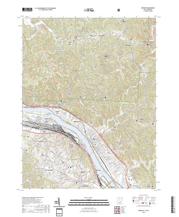
2023 Map of Ironton
USGS Topo · Published 2023About this map
The Ohio River serves as the central artery for this industrial and forested landscape, separating the city of Ironton and its riverbank neighborhoods from the Kentucky communities of Russell, Flatwoods, and Raceland. The urban core of Ironton is anchored by the Lawrence County Courthouse and Ohio University Southern, with dense residential grids extending toward the hills of the Wayne National Forest. To the north, the terrain shifts into the heavily wooded ridges and hollows of the forest, where a network of trails such as the Hanging Rock Loop Trl and Vesuvius Main Loop Trl traverse the landscape near Vesuvius Furnace.
Find a feature on this map
85 named features on this map. Tap any name to fly to it.
Don’t see what you’re looking for? This feature index may not catch every label — zoom into the map to look around manually.
Map Details
Editions of this 2023 Ironton Map
This is the sole edition of this map. No revisions or reprints were ever made.
Other maps of this area

1898 · Ironton
USGS Topo · 1:62,500

1900 · Ironton
USGS Topo · 1:62,500

1901 · Ceredo
USGS Topo · 1:62,500

1903 · Kenova
USGS Topo · 1:125,000

1904 · Kenova
USGS Topo · 1:125,000

1913 · Ceredo
USGS Topo · 1:62,500

1926 · Greenup
USGS Topo · 1:48,000

1930 · Greenup
USGS Topo · 1:62,500
1953 · Ashland
USGS Topo · 1:24,000

1953 · Greenup
USGS Topo · 1:24,000