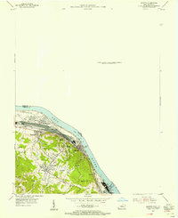
1953 Map of Ironton
USGS Topo · Published 1955About this map
The Ohio River corridor in the early 1950s is dominated by the industrial and transport infrastructure connecting Greenup and Boyd Counties. The heavy tracks of the Chesapeake and Ohio railroad run parallel to the river, serving a landscape of emerging residential hubs and established industrial sites like the Sand Pit and a southern Gas Field. Settlements such as Russell, Flatwoods, and Worthington are shown in high detail, illustrating the post-war expansion of these riverside communities. Local genealogists will find significant value in the numerous family and community landmarks, including Rude Cem, Caroline Cem, and the Baldridge Cem. Educational and spiritual life is anchored by sites like Indian Run Ch and Advance Sch, while the Ashland-Boyd County Airport and the Toll Bridge highlight the era's regional connectivity.
Find a feature on this map
30 named features on this map. Tap any name to fly to it.
Don’t see what you’re looking for? This feature index may not catch every label — zoom into the map to look around manually.
Map Details
Editions of this 1953 Ironton Map
This is the sole edition of this map. No revisions or reprints were ever made.
Other maps of this area

1898 · Ironton
USGS Topo · 1:62,500

1900 · Ironton
USGS Topo · 1:62,500

1901 · Ceredo
USGS Topo · 1:62,500

1903 · Kenova
USGS Topo · 1:125,000

1904 · Kenova
USGS Topo · 1:125,000

1913 · Ceredo
USGS Topo · 1:62,500

1926 · Greenup
USGS Topo · 1:48,000

1930 · Greenup
USGS Topo · 1:62,500
1953 · Ashland
USGS Topo · 1:24,000

1953 · Greenup
USGS Topo · 1:24,000