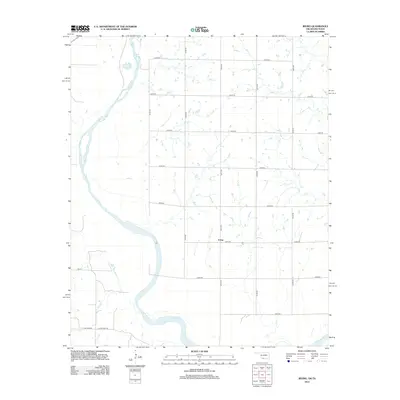
2012 Map of Irving
USGS Topo · Published 2012About this map
Red River meanders across the southwestern corner of this quadrangle, defining the border between Oklahoma and Texas. The small settlement of Irving sits on the northern side of this waterway, serving as a focal point for a landscape dominated by a rigorous grid of section line roads. These thoroughfares, including E2050 Rd and N2770 Rd, partition the Jefferson County terrain into large rectangular tracts, reflecting the enduring legacy of the Public Land Survey System. The infrastructure here is primarily agricultural and residential, with family-named routes such as Burrus Rd and L Schaffner Ln suggesting local genealogy and long-standing property lines. This 2012 survey captures the area as a modern rural community where the transition from Oklahoma's county roads to Texas routes like Fm 171 occurs at the river's edge.
Find a feature on this map
18 named features on this map. Tap any name to fly to it.
Don’t see what you’re looking for? This feature index may not catch every label — zoom into the map to look around manually.
Map Details
Editions of this 2012 Irving Map
This is the sole edition of this map. No revisions or reprints were ever made.
Other maps of this area

1901 · Addington
USGS Topo · 1:125,000

1905 · Montague
USGS Topo · 1:125,000

1954 · Sherman
USGS Topo · 1:250,000

1954 · Wichita Falls
USGS Topo · 1:250,000

1955 · Lawton
USGS Topo · 1:250,000

1956 · Henrietta
USGS Topo · 1:62,500

1957 · Hastings
USGS Topo · 1:62,500

1957 · Ardmore
USGS Topo · 1:250,000

1958 · Wichita Falls
USGS Topo · 1:250,000

1958 · Sherman
USGS Topo · 1:250,000