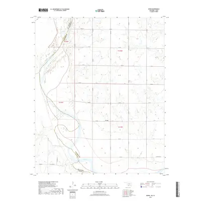
2019 Map of Irving
USGS Topo · Published 2019About this map
Red River provides a sweeping border between Clay and Jefferson Counties, marking the dividing line between Oklahoma and Texas in this southern plains landscape. The settlement of Irving sits at the center of a grid-iron road system, serving as a focal point for the surrounding agricultural tracts. The terrain is defined by the river’s wide, shifting basin and the small drainages that feed into it from the north. Local history and family ties are etched into the landscape through roads named for residents, such as F Schaffner Rd, L Schaffner Ln, and Burrus Rd. This survey documents the rural character of the region, where the section-line roads like Noble Wray Rd organize the landscape into a functional network of homesteads and fields typical of the Red River Valley.
Find a feature on this map
38 named features on this map. Tap any name to fly to it.
Don’t see what you’re looking for? This feature index may not catch every label — zoom into the map to look around manually.
Map Details
Editions of this 2019 Irving Map
This is the sole edition of this map. No revisions or reprints were ever made.
Other maps of this area

1901 · Addington
USGS Topo · 1:125,000

1905 · Montague
USGS Topo · 1:125,000

1954 · Sherman
USGS Topo · 1:250,000

1954 · Wichita Falls
USGS Topo · 1:250,000

1955 · Lawton
USGS Topo · 1:250,000

1956 · Henrietta
USGS Topo · 1:62,500

1957 · Hastings
USGS Topo · 1:62,500

1957 · Ardmore
USGS Topo · 1:250,000

1958 · Wichita Falls
USGS Topo · 1:250,000

1958 · Sherman
USGS Topo · 1:250,000