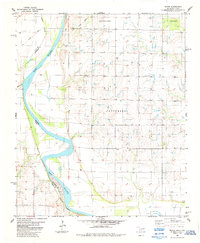
1984 Map of Irving
USGS Topo · Published 1985About this map
The Red River defines the borderland between Oklahoma and Texas in this 1980s topographic record, where the winding waterway carves through the landscape of Jefferson and Clay counties. The settlement of Irving sits on the northern side of the river, surrounded by the high-ground regions of Patterson and Bour Land. This survey reflects the rural character of the region during a period of steady land use, showing the distribution of small communities like Keele and Grayson amidst the natural drainage systems of Bailey Cr. The map's detailed contouring and boundary markings provide a precise look at the shifting riverbank and the dispersed homesteads and infrastructure that supported the local ranching and agricultural economy of the late 20th century.
Find a feature on this map
11 named features on this map. Tap any name to fly to it.
Don’t see what you’re looking for? This feature index may not catch every label — zoom into the map to look around manually.
Map Details
Editions of this 1984 Irving Map
This is the sole edition of this map. No revisions or reprints were ever made.
Other maps of this area

1901 · Addington
USGS Topo · 1:125,000

1905 · Montague
USGS Topo · 1:125,000

1954 · Sherman
USGS Topo · 1:250,000

1954 · Wichita Falls
USGS Topo · 1:250,000

1955 · Lawton
USGS Topo · 1:250,000

1956 · Henrietta
USGS Topo · 1:62,500

1957 · Hastings
USGS Topo · 1:62,500

1957 · Ardmore
USGS Topo · 1:250,000

1958 · Wichita Falls
USGS Topo · 1:250,000

1958 · Sherman
USGS Topo · 1:250,000