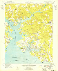
1949 Map of Irvington
USGS Topo · Published 1949About this map
The Corrotoman River splits into its Western Branch and Eastern Branch, defining the complex, water-locked geography of the Northern Neck during the late 1940s. Inland from the Rappahannock River, the landscape is a network of small landings and crossroads settlements. Significant social and commercial hubs like Kilmarnock and Irvington are shown alongside smaller points of interest such as Slaters Corner, where the local post office served the surrounding rural community. The presence of Dunton Mill and the Whitestone Wharf at Taft highlights the enduring maritime and local industrial character of Lancaster County. Notable landmarks for genealogical research include Christ Church, the Merry Point Sch, and Campbell Memorial Ch. The shoreline is heavily articulated with family-named points and coves, including Yopps Cove and Punches Cove, reflecting generations of land tenure along these tidal reaches.
Find a feature on this map
79 named features on this map. Tap any name to fly to it.
Don’t see what you’re looking for? This feature index may not catch every label — zoom into the map to look around manually.
Map Details
Editions of this 1949 Irvington Map
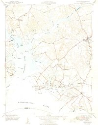
2 editions found
Other maps of this area

1916 · Kilmarnock
USGS Topo · 1:48,000

1917 · Heathsville
USGS Topo · 1:48,000

1917 · Urbanna
USGS Topo · 1:62,500

1917 · Morattico
USGS Topo · 1:62,500

1917 · Kilmarnock
USGS Topo · 1:62,500

1918 · Morattico
USGS Topo · 1:62,500

1926 · Morattico
USGS Topo · 1:62,500

1942 · Kilmarnock
USGS Topo · 1:62,500

1943 · Richmond
USGS Topo · 1:250,000

1944 · Reedville
USGS Topo · 1:31,680