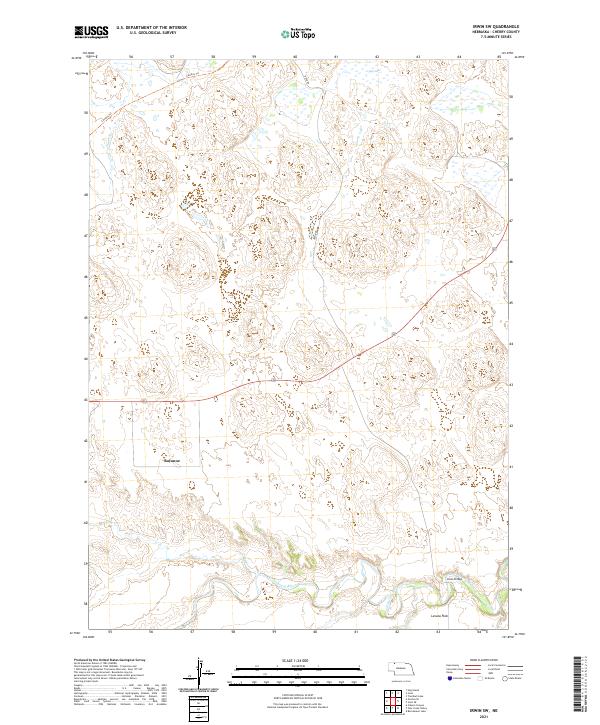
2021 Map of Irwin SW
USGS Topo · Published 2021About this map
The Niobrara River winds across the southern reaches of this Nebraska landscape, creating a distinct hydrological corridor defined by Hall Cr and Hay Cr. This river valley, which includes the Lavaca Flats, provides a sharp contrast to the undulating terrain and sandhills found further north. Near the river, Lions Bridge serves as a critical crossing point in a region where natural water features dictate the movement of roads and settlements. To the north, the former rail corridor of the Cowboy Trl cuts across the horizon near Gay Lake, while the small settlement of Bayonne remains a named point in the central Cherry County plains. The layout of Irwin Rd and section lines reflects the enduring rectangular survey system that has governed these Nebraska ranch lands for generations.
Find a feature on this map
15 named features on this map. Tap any name to fly to it.
Don’t see what you’re looking for? This feature index may not catch every label — zoom into the map to look around manually.
Map Details
Editions of this 2021 Irwin SW Map
This is the sole edition of this map. No revisions or reprints were ever made.
Other maps of this area

1950 · Irwin
USGS Topo · 1:62,500

1951 · Irwin
USGS Topo · 1:62,500

1951 · Gypsy Valley
USGS Topo · 1:62,500

1955 · Alliance
USGS Topo · 1:250,000

1957 · Alliance
USGS Topo · 1:250,000

1957 · Valentine
USGS Topo · 1:250,000

1958 · Alliance
USGS Topo · 1:250,000

1959 · Valentine
USGS Topo · 1:250,000
1969 · Gordon SE
USGS Topo · 1:24,000
1969 · Rushville 4 NE
USGS Topo · 1:24,000