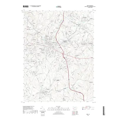
2019 Map of Irwin
USGS Topo · Published 2019About this map
Brush Creek and Little Sewickley Cr define the drainage of this Westmoreland County landscape, where closely clustered settlements reflect a dense history of industrial and residential growth. Larger hubs like Irwin and Jeannette sit alongside smaller named locales such as Shafton, Paintertown, and Hahntown, illustrating the patchwork of mid-century suburban expansion and older coal-era communities. The terrain is marked by numerous historic burial grounds, including Old Brush Creek Cem and Old Mars Hill Cem, which serve as vital landmarks for those researching the region's early families. Transport patterns are dominated by the winding paths of Paintertown Rd and Trafford Rd, which connect the various valleys and ridge-top neighborhoods. From the residential streets of Westmoreland City to the more open spaces near Evanstown, the map provides a comprehensive view of the area's physical and social geography near the end of the 2010s.
Find a feature on this map
333 named features on this map. Tap any name to fly to it.
Don’t see what you’re looking for? This feature index may not catch every label — zoom into the map to look around manually.
Map Details
Editions of this 2019 Irwin Map
This is the sole edition of this map. No revisions or reprints were ever made.
Other maps of this area

1902 · Brownsville
USGS Topo · 1:62,500

1902 · Connellsville
USGS Topo · 1:62,500

1904 · Mc Keesport
USGS Topo · 1:62,500

1904 · Greensburg
USGS Topo · 1:62,500

1906 · Brownsville
USGS Topo · 1:62,500

1906 · Greensburg
USGS Topo · 1:62,500

1907 · Pittsburg
USGS Topo · 1:62,500

1931 · Brownsville
USGS Topo · 1:62,500

1931 · Connellsville
USGS Topo · 1:62,500

1933 · Brownsville
USGS Topo · 1:62,500