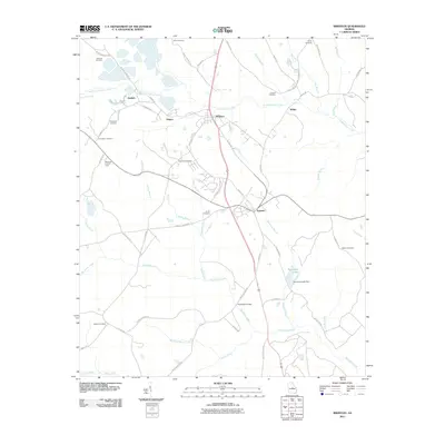
2011 Map of Irwinton
USGS Topo · Published 2011About this map
Irwinton and McIntyre serve as the primary hubs in this central Georgia landscape, where a dense network of country roads and family-named landmarks defines the local geography. The map reveals a high concentration of small family burial grounds, such as Holliman Cemetery, Brundage Cemetery, and Shepherd Cemetery, which provide critical touchpoints for genealogical research in the area. These sites are scattered across a terrain drained by numerous waterways including Commissioner Creek and Big Sandy Creek.
Find a feature on this map
65 named features on this map. Tap any name to fly to it.
Don’t see what you’re looking for? This feature index may not catch every label — zoom into the map to look around manually.
Map Details
Editions of this 2011 Irwinton Map
This is the sole edition of this map. No revisions or reprints were ever made.
Other maps of this area

1916 · Irwinton
USGS Topo · 1:62,500

1920 · Irwinton
USGS Topo · 1:62,500

1956 · Gordon
USGS Topo · 1:62,500

1956 · Jeffersonville
USGS Topo · 1:62,500

1957 · Macon
USGS Topo · 1:250,000

1958 · Macon
USGS Topo · 1:250,000

1964 · Macon
USGS Topo · 1:250,000
1973 · Gordon
USGS Topo · 1:24,000

1973 · Massey Hill
USGS Topo · 1:24,000
1973 · Napier Pond
USGS Topo · 1:24,000