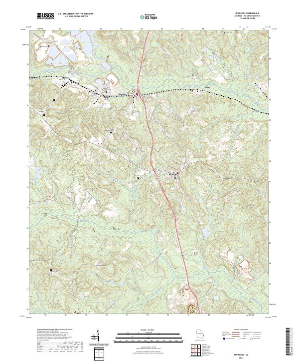
2024 Map of Irwinton
USGS Topo · Published 2024About this map
Irwinton serves as a central hub of Wilkinson County, where a network of local roads such as Macon Rd and Martin Luther King Rd converge. The landscape is defined by the drainages of Commissioner Creek to the north and the sprawling reach of Big Sandy Creek in the south, suggesting a topography shaped by these persistent watercourses. The area surrounding McIntyre and Edgars is particularly dense with family history, marked by numerous small burial grounds including the Holder Family Cem and the Brundage Mount Cem. This distribution of cemeteries and churches, like the Brundage Mount Baptist Church, reflects a long-standing rural community structure tied to specific family land tracts and small crossroads settlements like Wriley and Dedrich.
Find a feature on this map
75 named features on this map. Tap any name to fly to it.
Don’t see what you’re looking for? This feature index may not catch every label — zoom into the map to look around manually.
Map Details
Editions of this 2024 Irwinton Map
This is the sole edition of this map. No revisions or reprints were ever made.
Other maps of this area

1916 · Irwinton
USGS Topo · 1:62,500

1920 · Irwinton
USGS Topo · 1:62,500

1956 · Gordon
USGS Topo · 1:62,500

1956 · Jeffersonville
USGS Topo · 1:62,500

1957 · Macon
USGS Topo · 1:250,000

1958 · Macon
USGS Topo · 1:250,000

1964 · Macon
USGS Topo · 1:250,000
1973 · Gordon
USGS Topo · 1:24,000

1973 · Massey Hill
USGS Topo · 1:24,000
1973 · Napier Pond
USGS Topo · 1:24,000