
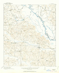
1916 Map of Irwinton
USGS Topo · Published 1963About this map
Irwinton serves as the focal point for this survey of Wilkinson County, situated amidst a landscape defined by the winding Oconee River and the prominent Beech Ridge. The 1916 landscape reveals a rural economy dependent on waterway crossings and rail transport, with the Central of Georgia railroad connecting the settlements of McIntyre and Toomsboro. Along the creek branches and ridges, numerous small schools like Hazelino School and Poplar Head School are spaced frequently, indicating a dispersed but organized community structure.
Find a feature on this map
71 named features on this map. Tap any name to fly to it.
Don’t see what you’re looking for? This feature index may not catch every label — zoom into the map to look around manually.
Map Details
Editions of this 1916 Irwinton Map
2 editions found
Other maps of this area

1912 · Milledgeville
USGS Topo · 1:62,500

1920 · Irwinton
USGS Topo · 1:62,500

1953 · Athens
USGS Topo · 1:250,000

1956 · Gordon
USGS Topo · 1:62,500

1956 · Jeffersonville
USGS Topo · 1:62,500

1957 · Macon
USGS Topo · 1:250,000

1958 · Macon
USGS Topo · 1:250,000

1958 · Athens
USGS Topo · 1:250,000

1959 · Athens
USGS Topo · 1:250,000

1961 · Deepstep
USGS Topo · 1:24,000