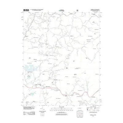
2011 Map of Isabella
USGS Topo · Published 2011About this map
Isabella and surrounding small settlements like Burger Town and Johnsonville populate the hills of Polk County in the early twenty-first century. This landscape is shaped by industrial history, evidenced by features such as the London Mills Tailings Pond Dam and the City Services Retention Dam along Burra Burra Creek. The map records a dense network of family-named landmarks and cemeteries, including the Bethlehem Cemetery and Neal Chapel Cemetery, which offer valuable points of interest for genealogists tracking local roots. High points like Shinbone Mountain and Stansbury Mountain rise above the drainage basins of North Potato Creek and South Shoal Creek. In the northeast, the religious park Fields of the Wood sits near Liberty, marking a distinctive cultural landmark in the Appalachian foothills.
Find a feature on this map
156 named features on this map. Tap any name to fly to it.
Don’t see what you’re looking for? This feature index may not catch every label — zoom into the map to look around manually.
Map Details
Editions of this 2011 Isabella Map
This is the sole edition of this map. No revisions or reprints were ever made.
Other maps of this area

1888 · Ellijay
USGS Topo · 1:125,000

1892 · Ellijay
USGS Topo · 1:125,000

1893 · Murphy
USGS Topo · 1:125,000

1898 · Ellijay
USGS Topo · 1:125,000

1911 · Ellijay
USGS Topo · 1:125,000

1914 · Murphy
USGS Topo · 1:125,000

1934 · Persimmon Creek
USGS Topo · 1:24,000

1934 · Unaka
USGS Topo · 1:24,000

1934 · Murphy
USGS Topo · 1:48,000

1935 · Epworth
USGS Topo · 1:24,000