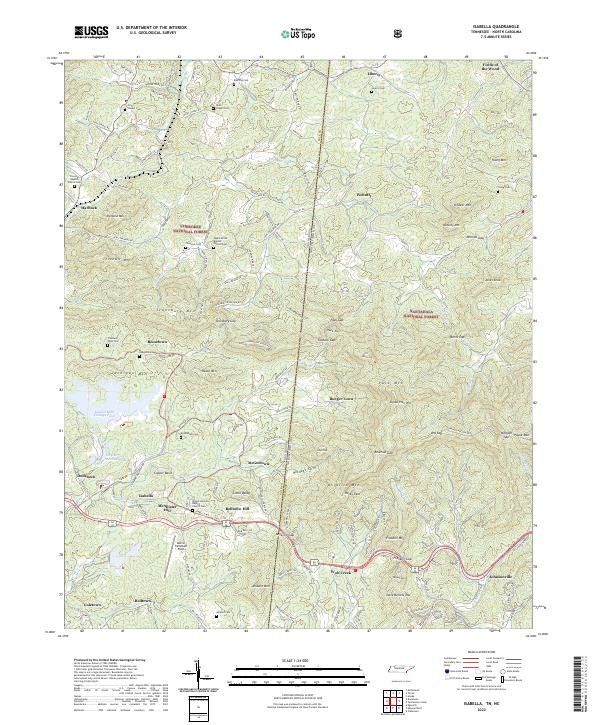
2022 Map of Isabella
USGS Topo · Published 2022About this map
Copper Basin defines the industrial and geographic character of this borderland where Tennessee and North Carolina meet. The landscape is marked by the complex relationship between resource extraction and the surrounding natural environment, most visible in the London Mills Tailings Pond and City Services Renton Pond near Ducktown. Small communities like Isabella, Burger Town, and McGeetown are scattered throughout the hills, many supported by a network of local churches and family burial grounds such as Bethlehem Cem and the Mount Harmony Baptist Church Cem.
Find a feature on this map
164 named features on this map. Tap any name to fly to it.
Don’t see what you’re looking for? This feature index may not catch every label — zoom into the map to look around manually.
Map Details
Editions of this 2022 Isabella Map
This is the sole edition of this map. No revisions or reprints were ever made.
Other maps of this area

1888 · Ellijay
USGS Topo · 1:125,000

1892 · Ellijay
USGS Topo · 1:125,000

1893 · Murphy
USGS Topo · 1:125,000

1898 · Ellijay
USGS Topo · 1:125,000

1911 · Ellijay
USGS Topo · 1:125,000

1914 · Murphy
USGS Topo · 1:125,000

1934 · Persimmon Creek
USGS Topo · 1:24,000

1934 · Unaka
USGS Topo · 1:24,000

1934 · Murphy
USGS Topo · 1:48,000

1935 · Epworth
USGS Topo · 1:24,000