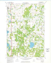
1974 Map of Isanti
USGS Topo · Published 1976About this map
The Burlington Northern railroad corridor anchors the western edge of this mid-1970s landscape, connecting the village of Isanti to the surrounding rural townships. This survey captures a transitional period of growth between Isanti and East Bethel, where traditional farming is increasingly punctuated by residential markers like the Trailer Park and new road networks including Fawnlake Drive and East Bethel Blvd.
Find a feature on this map
51 named features on this map. Tap any name to fly to it.
Don’t see what you’re looking for? This feature index may not catch every label — zoom into the map to look around manually.
Map Details
Editions of this 1974 Isanti Map
This is the sole edition of this map. No revisions or reprints were ever made.
Other maps of this area

1916 · St. Francis
USGS Topo · 1:62,500

1919 · St. Francis
USGS Topo · 1:62,500

1953 · Stillwater
USGS Topo · 1:250,000

1955 · Isanti
USGS Topo · 1:62,500

1955 · Stillwater
USGS Topo · 1:250,000

1958 · Stillwater
USGS Topo · 1:250,000

1961 · Bradford
USGS Topo · 1:24,000

1961 · Cambridge
USGS Topo · 1:62,500

1961 · Dalbo
USGS Topo · 1:62,500

1965 · Stillwater
USGS Topo · 1:250,000