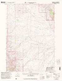
1997 Map of Island Butte
USGS Topo · Published 2002About this map
Island Butte stands as a prominent landmark in this high-altitude landscape within the Beaverhead National Forest, part of the Dillon Ranger District. The map captures a transition between the steeper elevations of Porcupine Canyon and the lower drainage basins where Nicholia Creek and Rock Creek converge. Human activity in this portion of Beaverhead County is reflected in isolated infrastructure and early industrial markers, including several Prospects located near Morrison Canyon. The presence of the Nicholia Sch and Whitworth Ranch indicates a history of sparse but established ranching and rural education. A complex network of water sources, from the isolated Coyote Lake to numerous named Springs and the South Fork of the creek system, highlights the critical importance of water management for survival and livestock in this environment.
Find a feature on this map
24 named features on this map. Tap any name to fly to it.
Don’t see what you’re looking for? This feature index may not catch every label — zoom into the map to look around manually.
Map Details
Editions of this 1997 Island Butte Map
This is the sole edition of this map. No revisions or reprints were ever made.
Other maps of this area

1955 · Dubois
USGS Topo · 1:250,000

1956 · Morrison Lake
USGS Topo · 1:62,500

1956 · Nicholia
USGS Topo · 1:62,500

1957 · Scott Peak
USGS Topo · 1:62,500

1958 · Dubois
USGS Topo · 1:250,000

1965 · Caboose Canyon
USGS Topo · 1:24,000

1965 · Graphite Mountain
USGS Topo · 1:24,000

1965 · Dixon Mountain
USGS Topo · 1:24,000

1965 · Island Butte
USGS Topo · 1:24,000

1980 · Leadore
USGS Topo · 1:100,000