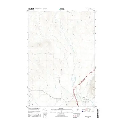
2014 Map of Island Falls
USGS Topo · Published 2014About this map
The West Branch Mattawamkeag River defines the landscape of this Aroostook County township, winding through a network of waterways and low-lying wetlands. The village of Island Falls serves as the primary hub in the south, where the river meets Fish Stream and Sly Brook. The terrain rises to the east at Robinson Mtn and DeLette Ridge, while the northern reaches near the small settlement of Batesville remain sparsely populated, characterized by the Bates Cem and the descending waters of Stair Falls and Warren Falls. A complex system of logging and local roads, including Champion Paper Rd and Retreat Rd, highlights the region's historical and ongoing reliance on the timber industry. The alignment of Dyer Brook and several family-named roads indicates a long history of rural settlement and resource management in this northern Maine wilderness.
Find a feature on this map
36 named features on this map. Tap any name to fly to it.
Don’t see what you’re looking for? This feature index may not catch every label — zoom into the map to look around manually.
Map Details
Editions of this 2014 Island Falls Map
This is the sole edition of this map. No revisions or reprints were ever made.
Other maps of this area

1937 · Smyrna Mills
USGS Topo · 1:62,500

1940 · Island Falls
USGS Topo · 1:62,500

1940 · Sherman
USGS Topo · 1:62,500

1941 · Mattawamkeag Lake
USGS Topo · 1:62,500

1942 · Island Falls
USGS Topo · 1:62,500

1942 · Sherman
USGS Topo · 1:62,500

1943 · Mattawamkeag Lake
USGS Topo · 1:62,500

1954 · Presque Isle
USGS Topo · 1:250,000

1954 · Millinocket
USGS Topo · 1:250,000

1955 · Smyrna Mills
USGS Topo · 1:62,500