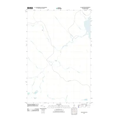
2011 Map of Island Pond
USGS Topo · Published 2011About this map
Red River and Fish River define this North Woods landscape of northern Maine, where a network of remote camps and timberland brooks dominate the terrain. Historically significant for its water systems, the map shows Red River Falls and the drainage patterns of Rocky Brook and McNally Brook as they converge toward the larger river basins. Isolated outposts such as Falls Camp and Fourmile Camp are positioned along these waterways, reflecting the region's long-standing connection to forestry and sporting traditions. To the south, a cluster of glacial lakes including Island Pond, Lucifee Pond, and Horseshoe Pond provide a distinct contrast to the winding river valleys. Modern access is represented by Fish Hachery Rd and Hewes Brook Rd, which cut through the dense hydrography of the Winterville Plantation area.
Find a feature on this map
21 named features on this map. Tap any name to fly to it.
Don’t see what you’re looking for? This feature index may not catch every label — zoom into the map to look around manually.
Map Details
Editions of this 2011 Island Pond Map
This is the sole edition of this map. No revisions or reprints were ever made.
Other maps of this area

1928 · Eagle Lake
USGS Topo · 1:48,000

1928 · Winterville
USGS Topo · 1:48,000

1930 · St Francis
USGS Topo · 1:48,000

1931 · Fish River Lake
USGS Topo · 1:48,000

1931 · Eagle Lake
USGS Topo · 1:62,500

1931 · Winterville
USGS Topo · 1:62,500

1933 · St Francis
USGS Topo · 1:62,500

1935 · Fish River Lake
USGS Topo · 1:62,500

1954 · Presque Isle
USGS Topo · 1:250,000

1958 · Presque Isle
USGS Topo · 1:250,000