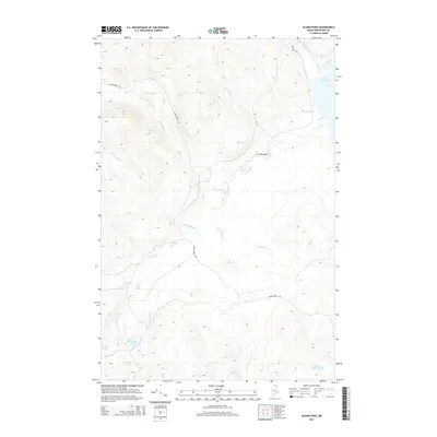
2014 Map of Island Pond
USGS Topo · Published 2014About this map
Saint Froid Lake and the winding Birch River define the eastern edge of this northern Maine landscape, where water and topography dictate the path of human transit. The Red River Rd and Hewes Brook Rd navigate a dense network of drainages, including the complex headwaters of the Red River and Birch River Reservoir. This area is characterized by its high concentration of interconnected ponds and streams, such as the secluded Island Pond, Horseshoe Pond, and the aptly named Lucifee Pond. The presence of Red River Falls and the prominent Red Ledge outcrop provide key navigational markers for those exploring the backcountry or tracing old logging routes. This survey illustrates how the northern forest's water systems, from Buggy Brook to Dead Brook, create a segmented terrain that remains largely defined by its natural hydrology and limited road access.
Find a feature on this map
21 named features on this map. Tap any name to fly to it.
Don’t see what you’re looking for? This feature index may not catch every label — zoom into the map to look around manually.
Map Details
Editions of this 2014 Island Pond Map
This is the sole edition of this map. No revisions or reprints were ever made.
Other maps of this area

1928 · Eagle Lake
USGS Topo · 1:48,000

1928 · Winterville
USGS Topo · 1:48,000

1930 · St Francis
USGS Topo · 1:48,000

1931 · Fish River Lake
USGS Topo · 1:48,000

1931 · Eagle Lake
USGS Topo · 1:62,500

1931 · Winterville
USGS Topo · 1:62,500

1933 · St Francis
USGS Topo · 1:62,500

1935 · Fish River Lake
USGS Topo · 1:62,500

1954 · Presque Isle
USGS Topo · 1:250,000

1958 · Presque Isle
USGS Topo · 1:250,000