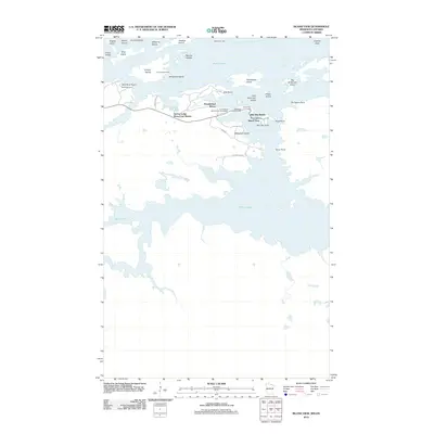
2012 Map of Island View
USGS Topo · Published 2012About this map
Rainy Lake dominates this northern borderland, where a complex network of islands and points defines the transition between land and water. The community of Island View serves as a central hub for the area's seasonal and recreational life, supported by a density of established lakeside destinations including the Sha-Sha Resort, Island View Lodge, and the Thunderbird Resort. Access to the interior waters is facilitated through Spring Lodge Resort and Marina, while landmarks like the Black Bay Lookout Tower and Bald Rock Light provide essential navigation and fire-watch perspectives over the expansive archipelago.
Find a feature on this map
38 named features on this map. Tap any name to fly to it.
Don’t see what you’re looking for? This feature index may not catch every label — zoom into the map to look around manually.
Map Details
Editions of this 2012 Island View Map
This is the sole edition of this map. No revisions or reprints were ever made.
Other maps of this area

1919 · International Falls
USGS Topo · 1:62,500

1954 · International Falls
USGS Topo · 1:250,000

1957 · International Falls
USGS Topo · 1:250,000

1958 · International Falls
USGS Topo · 1:250,000

1963 · Ranier
USGS Topo · 1:24,000

1969 · Island View
USGS Topo · 1:24,000

1969 · Ericsburg
USGS Topo · 1:24,000

1969 · Ray
USGS Topo · 1:24,000

1969 · Cranberry Bay
USGS Topo · 1:24,000

1969 · Ranier
USGS Topo · 1:24,000