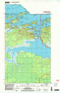
1999 Map of Island View
USGS Topo · Published 2003About this map
Island View serves as a gateway to the northern water-bound borderlands, where the Ontario Minnesota Boundary threads through the island-choked waters of Rainy Lake. The landscape is dominated by the sprawling reaches of Voyageurs National Park and the deep woods of the Koochiching State Forest, connected by a network of seasonal routes including the Winter Trail. Navigation is the primary theme of the area, centered on landmarks like the Black Bay Lookout Tower and the Rainy Lake Visitor Center. The map details a complex archipelago including Little American Island, Grindstone Island, and the uniquely named Aeroplane Island. To the south, the terrain shifts into the marshy lowland drainage of the Root River, illustrating the rugged and transitionary nature of this border region near the turn of the 21st century.
Find a feature on this map
47 named features on this map. Tap any name to fly to it.
Don’t see what you’re looking for? This feature index may not catch every label — zoom into the map to look around manually.
Map Details
Editions of this 1999 Island View Map
This is the sole edition of this map. No revisions or reprints were ever made.
Other maps of this area

1919 · International Falls
USGS Topo · 1:62,500

1954 · International Falls
USGS Topo · 1:250,000

1957 · International Falls
USGS Topo · 1:250,000

1958 · International Falls
USGS Topo · 1:250,000

1963 · Ranier
USGS Topo · 1:24,000

1969 · Island View
USGS Topo · 1:24,000

1969 · Ericsburg
USGS Topo · 1:24,000

1969 · Ray
USGS Topo · 1:24,000

1969 · Cranberry Bay
USGS Topo · 1:24,000

1969 · Ranier
USGS Topo · 1:24,000