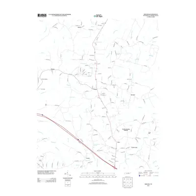
2013 Map of Isoline
USGS Topo · Published 2013About this map
The Obed River and its numerous tributaries, including Drowning Cr and Clear Cr, define the topography of this Tennessee landscape in the early 2010s. This survey records a transition from the developing North Crossville Addition in the south to more rural communities like Isoline and Woody further north. The map documents a complex network of local roads named for established families and agricultural use, such as Potato Farm Rd, Old Elmore Rd, and Adams Creek Lake. Notable water features like the Downing Creek Reservoir and the Caney Fork Cr illustrate the drainage patterns of the Cumberland Plateau. For those tracing local history, the map identifies small settlements and crossings such as Hughell Crossing and Tabor, which have served as local focal points for generations.
Find a feature on this map
159 named features on this map. Tap any name to fly to it.
Don’t see what you’re looking for? This feature index may not catch every label — zoom into the map to look around manually.
Map Details
Editions of this 2013 Isoline Map
This is the sole edition of this map. No revisions or reprints were ever made.
Other maps of this area

1887 · Kingston
USGS Topo · 1:125,000

1891 · Kingston
USGS Topo · 1:125,000

1892 · Pikeville
USGS Topo · 1:125,000

1893 · Kingston
USGS Topo · 1:125,000

1895 · Wartburg
USGS Topo · 1:125,000

1895 · Pikeville
USGS Topo · 1:125,000

1896 · Wartburg
USGS Topo · 1:125,000

1897 · Standingstone
USGS Topo · 1:125,000

1898 · Standingstone
USGS Topo · 1:125,000

1912 · Crossville
USGS Topo · 1:62,500