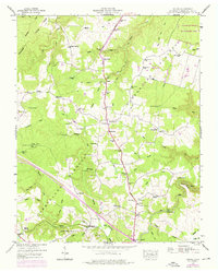
1946 Map of Isoline
USGS Topo · Published 1976About this map
The Cumberland Plateau landscape around Isoline is defined by a deep network of family cemeteries and rural schoolhouses situated between the Tennessee Divide and the Obed River. This mid-century survey reveals the importance of local infrastructure such as the Tennessee Central railroad and the Alvin C York Highway in connecting isolated communities like Creston and Coley. The terrain is etched with uniquely named watercourses, including No Business Branch and How Come You Creek, highlighting the deep vernacular history of the region.
Find a feature on this map
65 named features on this map. Tap any name to fly to it.
Don’t see what you’re looking for? This feature index may not catch every label — zoom into the map to look around manually.
Map Details
Editions of this 1946 Isoline Map
This is the sole edition of this map. No revisions or reprints were ever made.
Other maps of this area

1887 · Kingston
USGS Topo · 1:125,000

1891 · Kingston
USGS Topo · 1:125,000

1892 · Pikeville
USGS Topo · 1:125,000

1893 · Kingston
USGS Topo · 1:125,000

1895 · Wartburg
USGS Topo · 1:125,000

1895 · Pikeville
USGS Topo · 1:125,000

1896 · Wartburg
USGS Topo · 1:125,000

1897 · Standingstone
USGS Topo · 1:125,000

1898 · Standingstone
USGS Topo · 1:125,000

1912 · Crossville
USGS Topo · 1:62,500