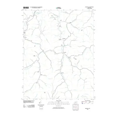
2010 Map of Isonville
USGS Topo · Published 2010About this map
Newcombe Creek and its many winding tributaries define the settlement patterns of this corner of Elliott County. The landscape is dotted with small communities such as Isonville, Newcombe, Burke, and Eldridge, each situated along the narrow valley floors. Family history is well-preserved through numerous burial grounds, including the Arthur Bays Cemetery, Watson Cemetery, and Gilliam Cemetery. The terrain is characterized by a dense network of hollows and flats, such as Shanty Hollow and Fraley Flat, while the higher elevations are marked by landmarks like the Peters Hill OutTower and Buck Knob. Along the northwestern edge, the waters of Grayson Lake begin to back into the Little Sandy River valley, illustrating the intersection of natural drainage and modern water management.
Find a feature on this map
90 named features on this map. Tap any name to fly to it.
Don’t see what you’re looking for? This feature index may not catch every label — zoom into the map to look around manually.
Map Details
Editions of this 2010 Isonville Map
This is the sole edition of this map. No revisions or reprints were ever made.
Other maps of this area

1886 · Prestonsburg
USGS Topo · 1:125,000

1889 · Salyersville
USGS Topo · 1:125,000

1891 · Salyersville
USGS Topo · 1:125,000

1892 · Prestonsburg
USGS Topo · 1:125,000

1899 · Salyersville
USGS Topo · 1:125,000

1903 · Kenova
USGS Topo · 1:125,000

1904 · Kenova
USGS Topo · 1:125,000

1915 · Paintsville
USGS Topo · 1:48,000

1917 · Paintsville
USGS Topo · 1:62,500

1950 · Bruin
USGS Topo · 1:24,000