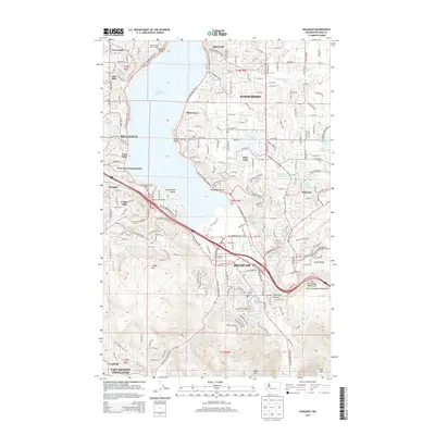
2014 Map of Issaquah
USGS Topo · Published 2014About this map
Lake Sammamish anchors the center of this 2014 survey, which highlights the rapid suburbanization and preserved natural spaces of the Eastside during the early 21st century. The growing city of Issaquah sits at the foot of the "Issaquah Alps," with steep topographical contours rising toward Cougar Mtn, Squak Mountain, and Tiger Mtn. This period shows the complex interface between high-density residential developments like Klahanie and large protected areas, including the City of Issaquah Watershed. Locally significant sites such as the Sammamish Bible Camp and Hillside Cem provide clear points of reference for genealogists and local historians. The map also records several lakeside communities such as Rosemont Beach and Alexander Beach, illustrating the transition of these shorelines from recreational outposts to permanent residential neighborhoods.
Find a feature on this map
94 named features on this map. Tap any name to fly to it.
Don’t see what you’re looking for? This feature index may not catch every label — zoom into the map to look around manually.
Map Details
Editions of this 2014 Issaquah Map
This is the sole edition of this map. No revisions or reprints were ever made.
Other maps of this area

1895 · Snohomish
USGS Topo · 1:125,000

1897 · Tacoma
USGS Topo · 1:125,000

1897 · Seattle
USGS Topo · 1:125,000

1900 · Tacoma
USGS Topo · 1:125,000

1913 · Cedar Lake
USGS Topo · 1:125,000

1921 · Sultan
USGS Topo · 1:125,000

1923 · Sultan
USGS Topo · 1:125,000

1949 · Maple Valley
USGS Topo · 1:24,000

1949 · Renton
USGS Topo · 1:24,000

1950 · Redmond
USGS Topo · 1:24,000