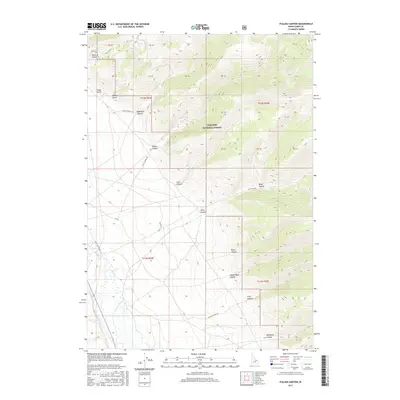
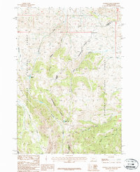
2017 Map of Italian Canyon
USGS Topo · Published 2017About this map
Targhee National Forest dominates the high-elevation terrain of this Lemhi County landscape, where deep drainages carve through the eastern slopes of the Beaverhead Mountains. The map reveals a complex network of topographical features named for early settlers and local landmarks, including Italian Canyon, Eidelman Canyon, and Irish Canyon. These deep incisions provide critical drainage for the region, eventually leading toward the valley floor where Birch Cr flows. This 2017 survey details the access routes used for forest management and recreation, such as Scott Canyon Rd and Nat For Dev Rd 272. The land is divided into a clear Public Land Survey System grid, visible through the township and range boundaries of t11n r29e and t12n r30e, illustrating the intersection of federal forest land and traditional western land division.
Find a feature on this map
22 named features on this map. Tap any name to fly to it.
Don’t see what you’re looking for? This feature index may not catch every label — zoom into the map to look around manually.
Map Details
Editions of this 2017 Italian Canyon Map
This is the sole edition of this map. No revisions or reprints were ever made.
Other maps of this area

1955 · Dubois
USGS Topo · 1:250,000
1956 · Nicholia
USGS Topo · 1:62,500
1957 · Diamond Peak
USGS Topo · 1:62,500
1957 · Scott Peak
USGS Topo · 1:62,500

1958 · Dubois
USGS Topo · 1:250,000
1969 · Copper Mtn
USGS Topo · 1:24,000
1969 · Blue Dome
USGS Topo · 1:24,000
1983 · Dubois
USGS Topo · 1:100,000
1987 · Eighteenmile Peak
USGS Topo · 1:24,000
1987 · Deadman Lake
USGS Topo · 1:24,000