1983 Map of Ivanpah
USGS Topo · Published 1983About this map
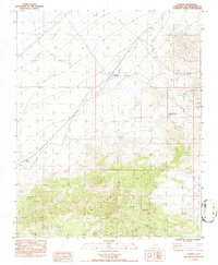
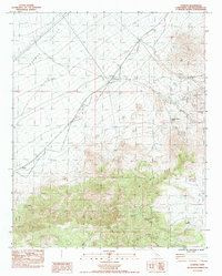
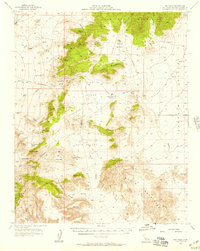
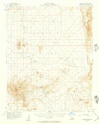
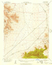
The high desert landscape of Ivanpah Valley and the northern reaches of the New York Mountains define this region in the early 1980s. The settlement of Ivanpah sits at a crossroads of the modern Union Pacific Railroad and an older era of transport, marked clearly by the Old Railroad Grade that cuts across the valley floor. This transition between the flat expanse and the rising slopes reveals a history deeply tied to mining and reliable water sources in an arid environment.
Find a feature on this map
27 named features on this map. Tap any name to fly to it.
Don’t see what you’re looking for? This feature index may not catch every label — zoom into the map to look around manually.
Map Details
Editions of this 1983 Ivanpah Map
2 editions found
Other maps of this area

1910 · Ivanpah
USGS Topo · 1:250,000

1912 · Ivanpah
USGS Topo · 1:250,000

1942 · Ivanpah
USGS Topo · 1:250,000

1947 · Kingman
USGS Topo · 1:250,000

1948 · Kingman
USGS Topo · 1:250,000

1954 · Kingman
USGS Topo · 1:250,000

1955 · Kingman
USGS Topo · 1:250,000
1955 · Mid Hills
USGS Topo · 1:62,500
1956 · Lanfair Valley
USGS Topo · 1:62,500
1956 · Ivanpah
USGS Topo · 1:62,500