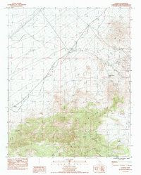
1983 Map of Ivanpah
USGS Topo · Published 1985About this map
Ivanpah Valley and the northern reaches of the New York Mountains dominate this high-desert survey, where industrial history is etched into the terrain. The small settlements of Ivanpah and Brant serve as focal points along the Union Pacific Railroad, while an Old Railroad Grade further north traces an earlier transportation network. This landscape is defined by its mining legacy, with numerous operations clustered in the canyons of the south and east.
Find a feature on this map
29 named features on this map. Tap any name to fly to it.
Don’t see what you’re looking for? This feature index may not catch every label — zoom into the map to look around manually.
Map Details
Editions of this 1983 Ivanpah Map
2 editions found
Other maps of this area

1910 · Ivanpah
USGS Topo · 1:250,000

1912 · Ivanpah
USGS Topo · 1:250,000

1942 · Ivanpah
USGS Topo · 1:250,000

1947 · Kingman
USGS Topo · 1:250,000

1948 · Kingman
USGS Topo · 1:250,000

1954 · Kingman
USGS Topo · 1:250,000

1955 · Kingman
USGS Topo · 1:250,000

1955 · Mid Hills
USGS Topo · 1:62,500
1956 · Lanfair Valley
USGS Topo · 1:62,500

1956 · Ivanpah
USGS Topo · 1:62,500