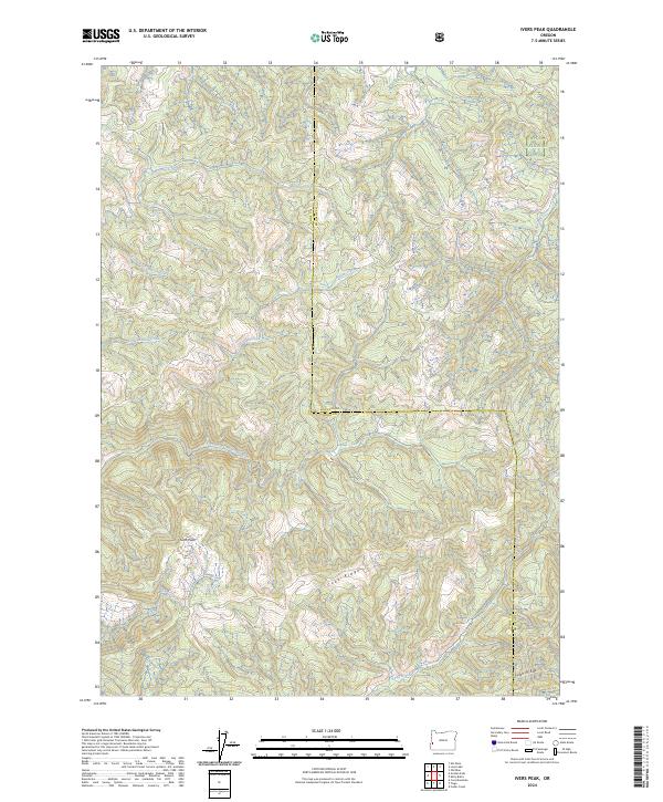
2024 Map of Ivers Peak
USGS Topo · Published 2024About this map
The divide between Coos and Douglas counties is defined by a series of prominent elevations and creek drainages in this modern topographic map. Centered on the namesake Ivers Peak, the landscape is dominated by the sprawling headwaters of the East Fork Millicoma River and the complex drainage systems of Matson Creek and its southern and little forks. The boundary between the counties follows the winding crests of Coos Ridge and High Ridge, marking the transition into the Umpqua National Forest at the northeastern corner. This area is characterized by heavy timberland management, evidenced by the presence of numerous forestry access routes like BLM Rd 24-8-35.1. The terrain is deeply incised by Beulah Creek, Fall Creek, and Bear Camp Creek, illustrating the drainage patterns that define this section of the Oregon Coast Range before these waters reach the lower valleys.
Find a feature on this map
19 named features on this map. Tap any name to fly to it.
Don’t see what you’re looking for? This feature index may not catch every label — zoom into the map to look around manually.
Map Details
Editions of this 2024 Ivers Peak Map
This is the sole edition of this map. No revisions or reprints were ever made.
Other maps of this area

1928 · Sitkum
USGS Topo · 1:125,000

1955 · Scottsburg
USGS Topo · 1:62,500

1955 · Ivers Peak
USGS Topo · 1:62,500

1955 · Tyee
USGS Topo · 1:62,500

1955 · Elkton
USGS Topo · 1:62,500

1958 · Roseburg
USGS Topo · 1:250,000

1959 · Roseburg
USGS Topo · 1:250,000

1979 · Roseburg
USGS Topo · 1:100,000

1979 · Cottage Grove
USGS Topo · 1:100,000
1985 · Loon Lake
USGS Topo · 1:24,000