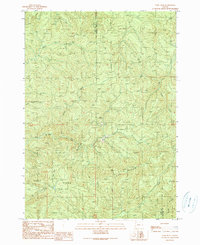
1990 Map of Ivers Peak
USGS Topo · Published 1990About this map
The East Fork Millicoma River carves through the heavily dissected terrain of the Oregon Coast Range along the Coos Co Douglas Co line. This landscape is defined by its deep drainage networks and prominent high points like Ivers Peak, which overlooks the convergence of numerous smaller watercourses such as Beulah Creek and Matson Creek. The presence of a Quarry and Tailings near the Millicoma River suggests a working landscape of resource extraction within these steep timberlands. High elevation dividers, including Coos Ridge and High Ridge, separate the watershed of the Bear Camp Creek from the lower river valleys, illustrating the complex topography that historically challenged transportation and logging operations in this corner of the state.
Find a feature on this map
14 named features on this map. Tap any name to fly to it.
Don’t see what you’re looking for? This feature index may not catch every label — zoom into the map to look around manually.
Map Details
Editions of this 1990 Ivers Peak Map
This is the sole edition of this map. No revisions or reprints were ever made.
Other maps of this area

1928 · Sitkum
USGS Topo · 1:125,000

1955 · Scottsburg
USGS Topo · 1:62,500

1955 · Ivers Peak
USGS Topo · 1:62,500

1955 · Tyee
USGS Topo · 1:62,500

1955 · Elkton
USGS Topo · 1:62,500

1958 · Roseburg
USGS Topo · 1:250,000

1959 · Roseburg
USGS Topo · 1:250,000

1979 · Roseburg
USGS Topo · 1:100,000

1979 · Cottage Grove
USGS Topo · 1:100,000
1985 · Loon Lake
USGS Topo · 1:24,000