
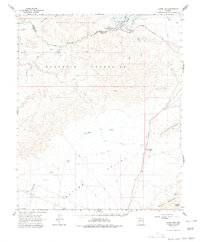
1966 Map of Ives Peak
USGS Topo · Published 1967About this map
Alamo Reservoir dominates the northern reaches of this desert landscape, where the Bill Williams River is captured by the Alamo Dam Spillway. The terrain is defined by the sharp rise of the Rawhide Mountains and the Buckskin Mountains, flanking the broad expanse of Butler Valley. This mid-century survey captures a transition in water management and land use, showing the intersection of the Mohave Co and Yuma Co borders amidst a rugged mining and ranching economy. Resource extraction is evident at the Arizona-Montana Mine and Bluebell Mine, while isolated outposts like Rankin Ranch and Conley Ranch highlight the sparse settlement patterns. A network of primitive transport, including a Jeep Trail and an unnamed Landing Strip in Reid Valley, connects these remote points through dry washes like Mississippi Wash and Cunningham Wash.
Find a feature on this map
28 named features on this map. Tap any name to fly to it.
Don’t see what you’re looking for? This feature index may not catch every label — zoom into the map to look around manually.
Map Details
Editions of this 1966 Ives Peak Map
2 editions found
Other maps of this area

1923 · Signal
USGS Topo · 1:250,000

1942 · Signal
USGS Topo · 1:250,000

1942 · Vicksburg
USGS Topo · 1:250,000

1950 · Prescott
USGS Topo · 1:250,000

1954 · Prescott
USGS Topo · 1:250,000

1954 · Phoenix
USGS Topo · 1:250,000

1957 · Phoenix
USGS Topo · 1:250,000

1958 · Prescott
USGS Topo · 1:250,000

1958 · Phoenix
USGS Topo · 1:250,000

1959 · Prescott
USGS Topo · 1:250,000