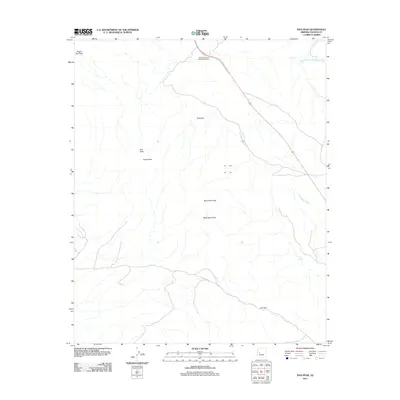
2011 Map of Ives Peak
USGS Topo · Published 2011About this map
Ives Peak and the surrounding high desert of Yavapai County are defined by a complex network of drainage basins and sharp topographical rises. In this 2011 survey, the landscape is marked by the South Fork Santa Maria River in the northeast and the prominent Black Mountains across the southern half of the quadrangle. The terrain is punctuated by significant summits including Violas Peak, McLendon Peak, and Negro Ben Peak, offering a clear view of the geological character of this arid region.
Find a feature on this map
11 named features on this map. Tap any name to fly to it.
Don’t see what you’re looking for? This feature index may not catch every label — zoom into the map to look around manually.
Map Details
Editions of this 2011 Ives Peak Map
This is the sole edition of this map. No revisions or reprints were ever made.
Other maps of this area

1923 · Signal
USGS Topo · 1:250,000

1942 · Signal
USGS Topo · 1:250,000

1950 · Prescott
USGS Topo · 1:250,000

1954 · Prescott
USGS Topo · 1:250,000

1958 · Prescott
USGS Topo · 1:250,000

1959 · Prescott
USGS Topo · 1:250,000

1960 · Prescott
USGS Topo · 1:250,000

1965 · Prescott
USGS Topo · 1:250,000
1967 · Date Creek Ranch NW
USGS Topo · 1:24,000
1967 · Arrastra Mtn SE
USGS Topo · 1:24,000